Sample Image from April 22, 2020
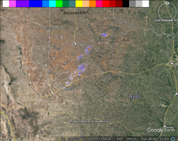
Download the file WestTexas_realtime.kml and open it in Google Earth to overlay the most recent ten minutes of West Texas LMA data on Google Earth. The image will automatically update once a minute.
Sample Image from April 22, 2020